Assignment for Team 2

The Planners Explain Scenarios or Options to the Developers and Environmentalists
at Public Workshop No. 4 (Feb. 1990)
Team 2 is made up of people working with Steve Gordon, an urban planner
with the Lane Council of Governments in Eugene, to create a plan for dealing
with the west Eugene wetlands. This team must introduce the 4th public workshop
at the community center in the west Eugene study area, February 1990. In
this workshop the team will do three things: (1) present the results of
the survey taken at the preceding workshop (Nov.
1989), (2) introduce a vision for the future of
the Amazon Creek basin and its wetlands for multiple purposes, and (3) offer
three alternative wetlands management scenarios for public discussion. On
the team are people from the City of Eugene Planning Office and members
of "the Wetheads," an interdepartmental and interagency staff
team managed by Steve Gordon of the Lane County Council of Governments,
which worked on contract with the City of Eugene (See the comprehensive
planning chart, the chart
for the organization of wetlands planning, and the chart
showing the relationship of local plans to the statewide plan). Team
members may use their own names and give themselves titles related to the
city planning department or to the LCOG project, called the West Eugene
Wetlands Special Area Study (WEWSAS).
Getting Started
To get started you might like to know more about
Background Information
In January 1989, the City of Eugene contracted with the Lane Council of
Governments to conduct the West Eugene Wetlands Special Area Study (WEWSAS)
and develop a comprehensive plan. The city council specified four objectives:
to use the best information available to help the community understand the
choices available: to find a balance between environmental protection and
sound urban development that meets state and federal laws and regulations;
to provide opportunities for all interested segments of the community to
be involved in development of the plan, and to turn a perceived "wetlands
problem" into a "wetlands opportunity " for the community.
The study was to cover approximately 8,000 acres in the Amazon Creek drainage
basin in west Eugene. During the study, 1,307 acres of wetlands were discovered.
The group recommended that 1,019 acres be protected and that 288 acres be
developed. In addition, upland areas were identified that provided valuable
connections between the wetland system and land to buffer wetlands from
adjacent impacts. As federal agencies wrangled over what constituted wetlands
and which ones had to be protected, the projected number of actual wetlands
in west Eugene rose and fell.
Your team does not need to sort out or mention the national policy conflicts
that caused these changes, although these are chronicled in the newspaper
accounts (news
32, 34,
and 37)
in this site if you are curious about them. Just realize that this is a
turbulent time and members of your audience will very likely have heard
inflammatory positions taken by various political figures and radio talk
show hosts.
Background on Oregon as a planning state and why Eugene's area for industrial
land is limited.
In response to rapid population growth and urbanization in the 1950s and
60s, the Oregon Legislature enacted the 1973 Oregon Land Use Planning Act,
which became famous as Senate Bill 100. The Act created a partnership between
state and local governments in land use planning and regulation of development.
The Land Conservation and Development Commission was to "prescribe
planning goals and objectives to be applied by state agencies, cities, counties,
and special districts throughout the state" (ORS 197.005). The bill
also established the Department of Land Conservation and Development to
administer statewide goals.
The state plan addressed four types of goals: citizen involvement, land
use planning, and conservation of farm and forest lands and their natural
resources, as well as conservation of coastal resources. Each city and county
had to develop a comprehensive plan meeting state standards and approved
by the LCDC. Each city had to define an urban growth boundary within which
urban development would be confined. Once these plans were approved, they
had the effect of law, and local and state land use activities had to be
made consistent with local comprehensive plans.
Eugene's approach to knowledge creation and citizen involvement
Eugene arranged a contract with Lane County to have its urban planner, Steve
Gordon, direct the West Eugene Wetland Special Area Study. Instead of creating
a citizen advisory committee, as some towns might have done, Gordon formed
a technical advisory committee , which was informally known as the "wetheads,"
who searched for the information citizens needed. It was composed of a representative
from the Environmental Protection Agency, the Army Corps of Engineers, the
U.S. Fish and Wildlife Service, the Division of State Lands, and the Department
of Environmental Quality, which helped guide the planning process. The Wethead's
mission was to develop information and take it to the people. This group
wrote reports, gave land owners guidance on scientific and legal aspects
of the study, commented on recommendations, and provided handouts and posters,
and staffed a station during workshops where citizens could ask detailed
technical questions. The team can assume that the Wetheads will be present
at the February 1990 meeting.
Citizen Input
To gather information about citizens' preferences, a survey form was developed
to gather information that would allow the planning group to prioritize
the protection of various wetlands, determine which wetlands were suitable
for development, determine the parameters for a wetland mitigation plan
(including types, ratios, and timeing), and plan ways of managing and financing
the restoration, replacement, and maintenance of a wetlands system. See
Results
The Current Situation

WEWSAS Wetheads conducted field trips and public workshops and prepared
mailings and newsletters to build a group of knowledgeable citizens who
could advocate a consensus. The outreach program tried to involve a large
cross-section of the community. Sometimes the Wetheads met with individual
property owners privately. The workshops drew big crowds--as many as a hundred
and fifty people--and some property owners attended all the meetings. Frustration
was the dominant mood until early in 1990. At the meetings Gordon felt they
had to make their presentations in such a way that the audience would understand
they had a common problem caused by changes in state and federal regulations,
not by local folks. Everyone would have to work together, Gordon believed.
The Audience You'll Face
Notices about your February 1990 workshop have been mailed to all interested
parties on the mailing list, and posters and news releases have been used
to advertise the workshop. Each affected property owner has been notified
about the workshop and has been mailed an information packet to encourage
their participation. About 150 people are expected, mostly developers, property
owners, and business people (primarily from the Eugene Community Association).
While many of these people appreciate the land, discovery of wetlands on
their properties has substantially affected the prospects of financial reward.
On the other hand, environmentalists suspected that natural resources would
be sacrificed to economic interests.
Divergent Views
The audience you're facing will contain people of divergent views. The following
letters to the editor are an indication of the range of feelings the audience
may have at this meeting:
"Wetlands
Destroyed," Letter to the Editor from the Eugene Register-Guard,
5/02/1989 (NWS 11)
"Shocking
Fiasco!" Letter to the Editor from the Eugene Register-Guard,
5/02/1989 (NWS 10)
The landowners ranged from ordinary individuals to big foundations and leading
families and developers. Expect ordinary pickup trucks and luxury cars in
the parking lot at the February meeting.
"Landowner's views" (excerpt
from NWS 46; The Register Guard) . . . .
There is no better illustration of the west Eugene protection-development
conflict than Stewart Pond, a muddy, grass-filled depression about five-minutes'
drive from downtown. On a recent sunny afternoon, red-winged blackbirds
danced in and out of the underbrush while a ring-necked pheasant flapped
low across the oozy surface. Bought in the late 1960s by the Hult family
as investment property, it was at one time slated to be filled and developed
as a commercial property--the kind of property that might have attracted
a major discount store or a medium-sized manufacturer.
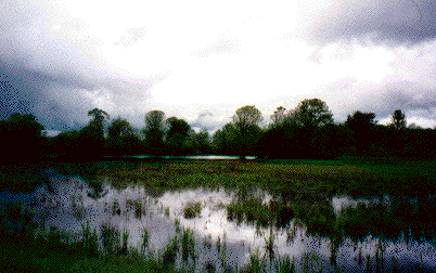 Stewart Pond
The Hults' land will fetch some twenty years' later just about the amount
they originally paid for it. Stewart Pond is slated to become a small wildlife
preserve according to the recommendations the team is to present at the
workshop. The regional office of the Bureau of Land Management (part of
the U.S. Department of the Interior) would maintain the property.
The Register-Guard tells the story behind the property:
A century ago, Stewart Pond would have been indistinguishable
from the surrounding marshes and lowlands that make up the Amazon Creek
drainage. Most of west Eugene was either swampland or grassland prairie
that remained wet in winter and dried out during the summer.
As Eugene grew, the meadows became farms. Considered worthless obstructions
to progress --too wet to farm, too unstable to build one -- wetlands were
filled in to make space for homes and businesses. Streets and highways divided
the marshes into separate ponds.
Environmentalists, however, took a different view. The nation's rapidly
disappearing swamps and bogs were home to a rich diversity of wildlife.
They played a critical role in flood control, and they served as giant water
purifiers that filtered out silt and chemical pollutants.
Under pressure from environmental groups, the U.S. Environmental Protection
Agency included wetlands protection in federal clean water laws during the
late 1970s. The only problem was, hardly anyone knew what a wetlands was.
(from NWS 45)
Instructions to the team
Your team will talk for a total of 15 or 20 minutes, or as your instructor
directs. Part of the talk will be to explain your communication strategy
for the workshop to the class. The rest of the presentation will simulate
the opening of the workshop. Your purpose at that workshop is to present
the results of the survey taken at the preceding workshop (Nov.
1989) and to introduce the three scenarios based on those results, on which
you're seeking citizen feedback. You will have two forms to gather results
at this February workshop: one that asks for citizen feedback on scenarios
A, B, and C, and another form that invites citizens to comment on individual
wetland sites within the study area. (See these forms in team resources.)
Use the summary information in the
"West Eugene Public Preference Survey Results,"
the wetlands map
showing different types of wetlands identified in the study, the two
forms that will be used to collect information from citizens, and information
about the purpose of the workshop to plan a 90-minute workshop, which
you will introduce with your ten-minute welcome and preview. Your ability
to set the tone for the whole event in those ten minutes will have a big
effect on its success.
Consult Survey Results to see a summary of
citizens' answers to the Nov. 1989 survey.
In addition to reporting on results, you need to introduce the three scenarios
for managing wetlands in west Eugene that have been developed on the basis
of the Nov. 1989 survey results. You should present the scenarios briefly.
These are
Scenario A, Scenario
B, and Scenario
C. Their main differences are summed up in the conclusions
of the "West Eugene Wetlands Special Area Study: Citizen Workshop No. 4, Wetlands
Information and Scenarios, February 24, 1990." The proportion of wetland acres
protected or developed in each of these scenarios varies as follows:
| Scenario A | Acres developed | 792 | Acres
protected | 578 |
| Scenario B | Acres developed |
510 | Acres protected | 860 |
| Scenario
C | Acres developed | 185 | Acres protected | 1185 |
These amounts are shown in a
chart.
No mitigation plan is included in the scenarios because the mitigation proposal
will be presented at the next citizen workshop planned for May
1990.
Part A.
Before you demonstrate your ten-minute presentation, one member of the team
should introduce the physical set-up and the team's persuasive strategy
for the meeting in a five-minute presentation. In the five-minute set-up
talk, present to the class a diagram of
the workshop room and their position as audience in it, showing how
you have positioned the displays, tables, and individuals from the Wetheads
for answering questions one on one and talking with individuals about their
properties, ideas, and suggestions. You can download the diagram of the
room and use a graphics program to manipulate the image to show what you'd
do; you can create a diagram of your own with a graphics program of your
choice; or simply print out the diagram and draw in the arrangements and
make a transparency from that. Turn in to the instructor a list of things
you believe will affect the audience's feelings and commitment to being
part of the solution to the problem.
Part B.
The rest of the team will give the class a ten- to fifteen-minute presentation
(according to the time limits given by your instructor) intended for the
people who come to the workshop from Eugene. People will want to know right
away how long your talk is going to take, who you are, and what's going
to happen. Use the time for
a welcome,
introduction of team members, and
an overview presentation of
the agenda for the workshop,
the survey results from November and
the three new scenarios on which you're seeking feedback.
The team's presentation launches the workshop and needs to create a friendly
mood in the audience, which includes people with divergent views and interests.
Think of ways that you can involve the audience after the presentation in
consensus building and announce to them in the presentation any actions
that you want them to take. To enable people to express their opinions,
you might consider such processes as "bean jar surveys," coloring
in their ideas and suggestions on blank maps and other things.
The team can decide to use the space (see diagram)
as it wishes. Remember that during the workshop people need to be able to
move about to obtain information, look at the three scenarios and maps,
get answers to questions about specific properties, obtain materials, sign
in and be welcomed, obtain refreshments, and talk. You may either have the
audience stand for the ten-minute presentation or bring in chairs and arrange
seating in the room. Think about the consequences of having seating vs.
allowing open flow. What problems arise with each arrangement, given the
differing stakes and attitudes of the audience? Your goal is to build as
much good will as possible.
Resources for the Team